
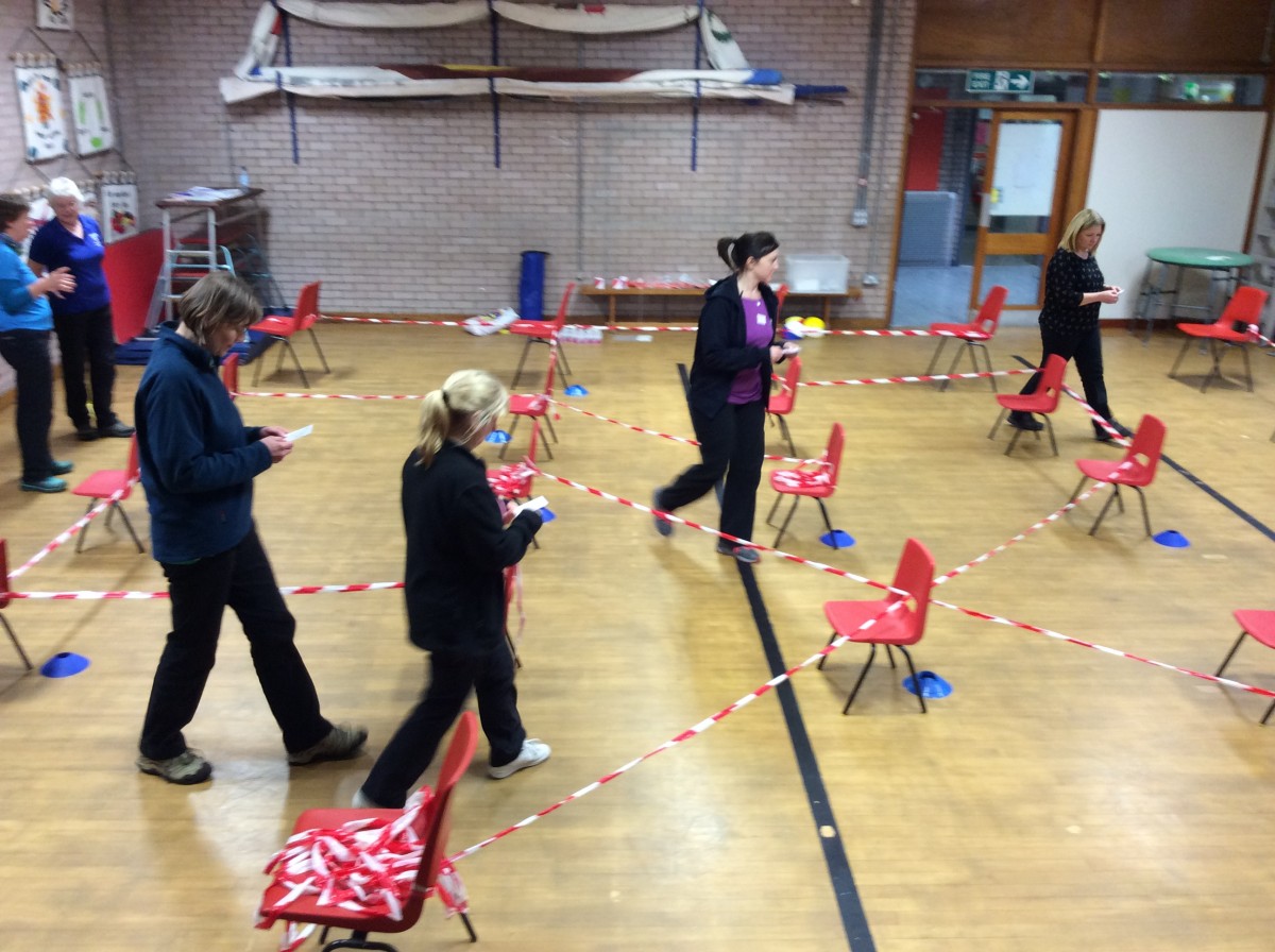
As part of our orienteering training we made an amazing maze in the hall – we think the children will enjoy orienteering their way through this as much as we did!

November 21, 2015
by Mrs Harrison
0 comments
As part of our orienteering training we made an amazing maze in the hall – we think the children will enjoy orienteering their way through this as much as we did!
November 21, 2015
by Mrs Harrison
0 comments
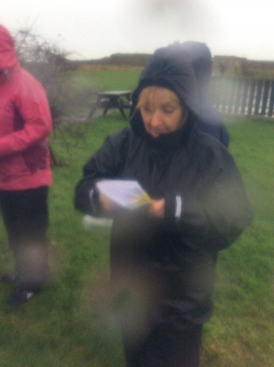
Lynn Walker from the Scottish Orienteering Association visited Port Ellen on the in-service day in Novemeber to train teachers how to teach orienteering. Everyone enjoyed the workshop – it was a lot of fun…..despite the rain!
November 3, 2015
by User deactivated
0 comments
Port Ellen Primary School P5/6/7 has been learning how to Orienteer. To sum up what they have achieved is quite remarkable.What they have been doing in oreeinteering this year such as making some course challenges, made a map of the school grounds, Google Maps course around Port Ellen, and they made a course round Islay on a map and put QR codes round the school .
The School got a grant of 2,000 so the school thought it would be a good idea to buy water proofs and other outdoor achievement for orienteering and other outside activates with the school. They have recently done a Google Maps course round Port Ellen with videos and pod casts.
I know they have been very successful in there orienteering topic and we hope they can continue this topic.
October 26, 2015
by Mrs Clark
0 comments
If you are at this checkpoint you will be able to see the ferry, the Port Ellen Lighthouse and the lookout hut. The pontoons are for people to keep their boats at when visiting Port Ellen. There is an information board showing where the free spaces are for mooring your boat. One of the things we like to do at the pontoons is crabbing. Here is a video explaining how to do it.
October 1, 2015
by User deactivated
1 Comment
When we were creating our own map, guess what happened?! A GOOGLE MAPS VAN WENT PAST!!!!!! It was such a coincidence! How did it know?!
October 1, 2015
by User deactivated
0 comments
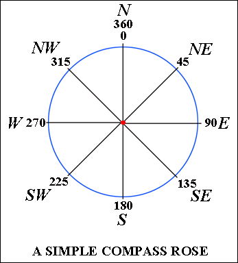
We have been learning about compass points because it helps us with our orienteering because you need to know your compass points to get to the markers. Here are all the compass points are north represented by an N then there is north-east represented by an NE after that there is east represented by an E then there is south east represented by a SE then there is then there south represented by an S and that is half the circle. Then on the other half of the circle, there is south west represented by SW then there is west represented W then there is north-west is represented by NW then is north again. There is a degree for each compass point which helps you to know if you’re facing the right way. When you change the degrees to north to east or to east to south you add 45 degrees on because each turn you do you add 45 degrees. North is either 360 or 0 and north-east is 45 degrees. East is 90 because 45 add 45 is 90 degrees. South east is 125 degrees. South is 180 degrees. South west is 225. West is 270 degrees and north west is 315. Then back to north which is 0 degrees.
October 1, 2015
by User deactivated
0 comments
The bearing of a point is the angle measured from the north line. Bearings help you find your destination so if you are new town bearings can help you around the place.
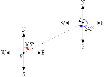 This diagram shows compass points and the bearings plus the angles of a compass. You can see the bearing of A from B is 065° and from B from A is 245°.
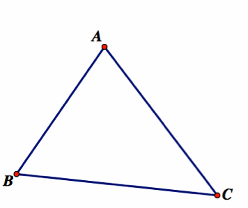
This is a triangle that is labelled a to b b to c and c to a.
A to B = South West
B to C = South East
C to A = North West
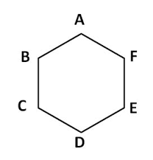
This is a hexagon labelled a b c d e f: A to B =south west
B to C= South C to D = South East D to E = North East E to F= North F to A =North West
By Ruaraidh and Rowan at Port Ellen Primary School
October 1, 2015
by Abi
0 comments
There are 2 lines that are on all maps and they are called the vertical and the horizontal lines. They are always in a straight line and they either go up and down or across the way. Grid references are between the lines which make it look like a maths square that has numbers. The difference between grid references and coordinates is that coordinates are where the lines meet and grid references are in between the lines. We are learning about grid references in school and we already know six figure grid references and four figure references. Every ordnance survey map in the world has a six figure grid references and a four figure grid references for every place. We also learnt about coordinates. We played battleships to help understand grid references. We know you say the horizontal line first and the vertical line after. The horizontal line is the X axis at the bottom and the vertical line is the Y axis.
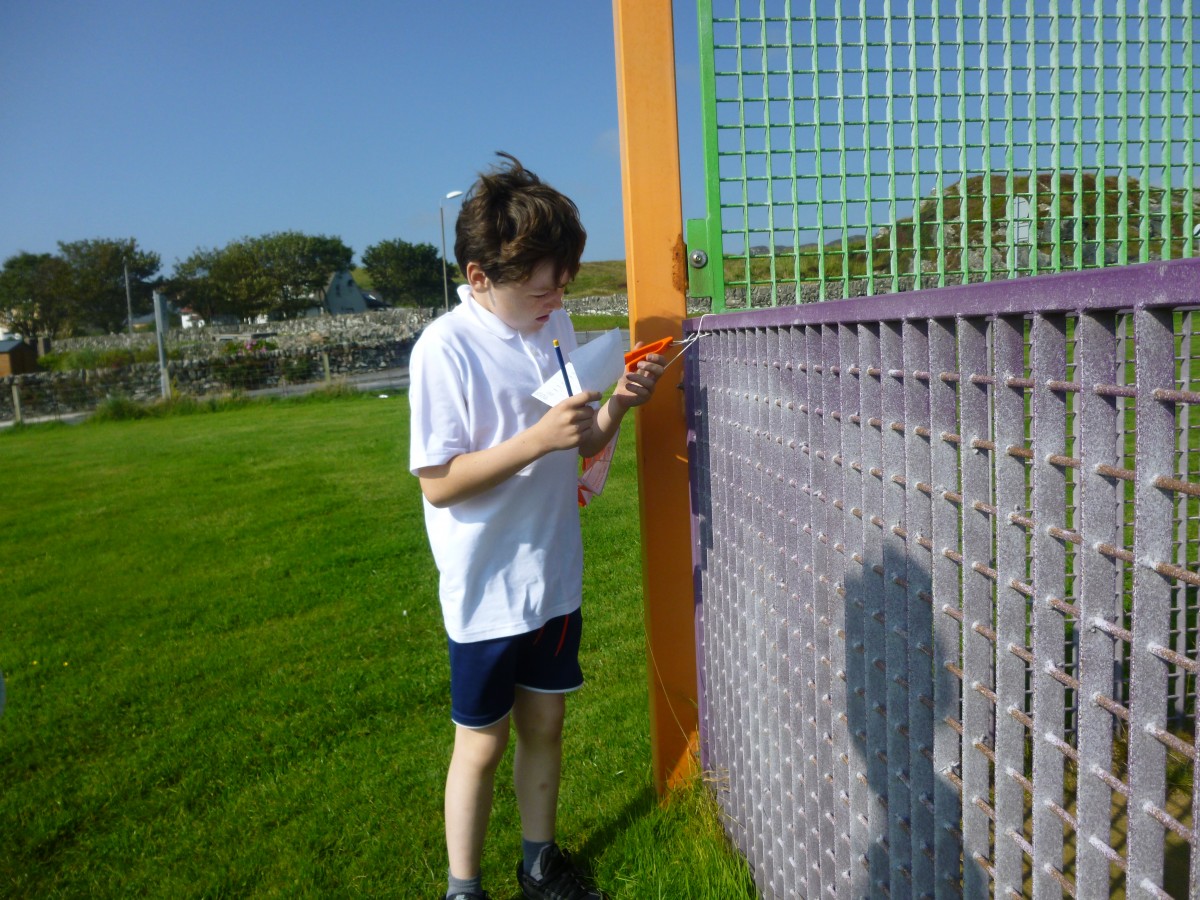
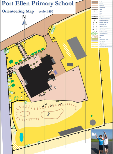
We found a map of the school and we thought it would be a good map to use for orienteering because the one we have is old and things aren’t in the same place anymore. Then we realised we didn’t have some things on the new map so we went outside and measured the things that weren’t there by how wide they are, how long they are and how far away from some things like the school and the fences area. After that we measured them to scale and put them on our map. Now we use the map to make up orienteering courses. This is the map we use and we use it to do orienteering in school.
October 1, 2015
by User deactivated
0 comments
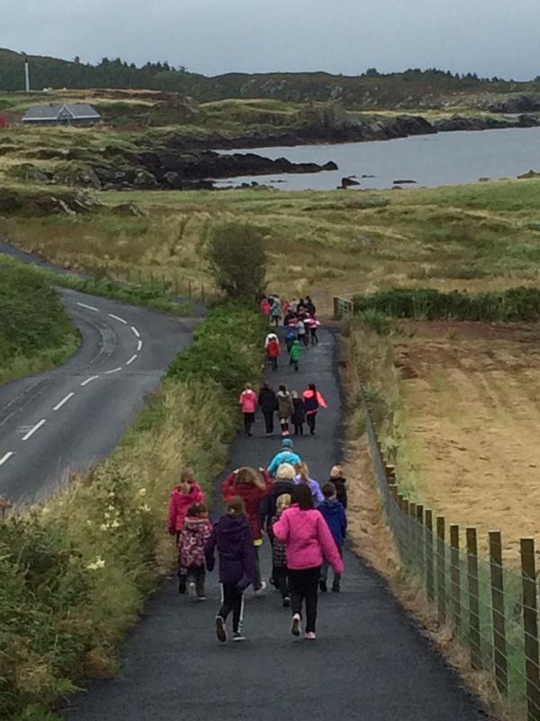 P5/6/7 wanted to do a mile walk or a mile run to improve our fitness. But first we had to calculate and measure how long a mile is. We had to use Google maps to see how much it takes for a mile from up the path and back. We were going to go up the path but we did not want to go 2 miles so we used Google maps to see how it is a
 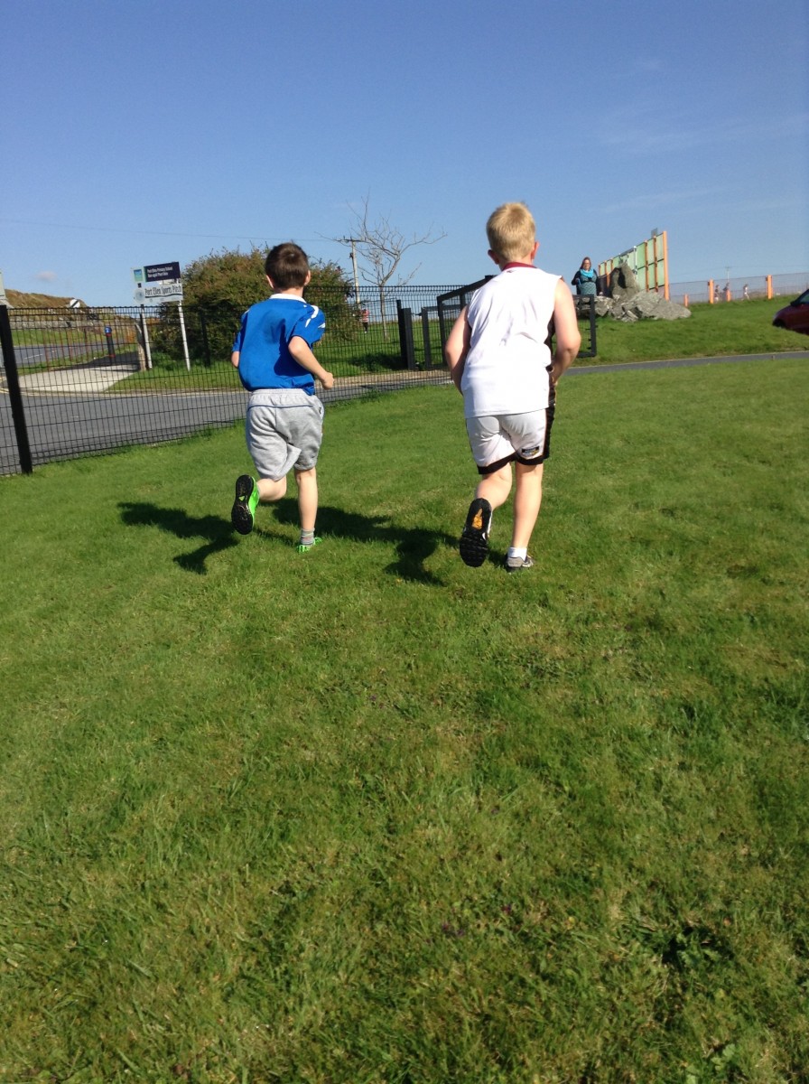 mile from somewhere on the path and back. Our class found out that it stopped at a wee bay right beside a stone wall. We thought if we go around the school a lot of times we could measure the school and see how many time it would take to do a mile. For the run we had to time each other to see if we improve each week. For the run we had to run around the edges 4 times. We know that running around the school 4 times because we measured it on the app called Map My Walk.
October 1, 2015
by Sarah Jolene
0 comments
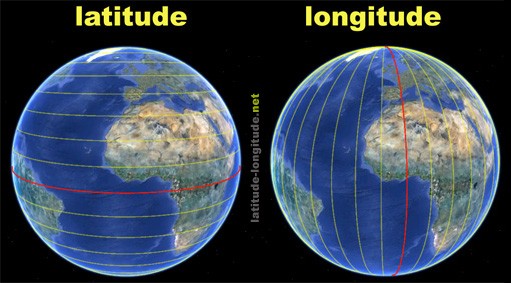 Port Ellen Primary School P5/6/7 have been learning about longitude and latitude. Latitude and longitude are invisible lines on a globe that people use to get around (Navigation). We also use them to find locations if we are lost or some where new. Longitude lines are the ones that go up the way and latitude lines are the ones that go across the way.

Glow Blogs uses cookies to enhance your experience on our service. By using this service or closing this message you consent to our use of those cookies. Please read our Cookie Policy.